19th Century
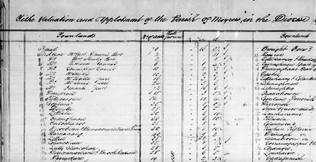
There is a little more written information available regarding the 19th century. One of earliest documents available about the townlands is included in ‘The Tithe Valuation and Applotment of the Parish of Moyros in the Diocese of Tuam’. This information was collected by valuators between 1823 and 1837 to determine what amount of tax each tenant had to pay to the Church of Ireland.
http://titheapplotmentbooks.nationalarchives.ie/pagestab/Galway/
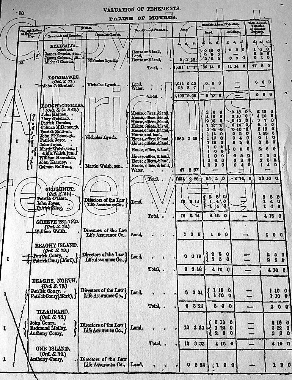
Another valuation was carried out in 1842 (below) and gives more detailed information about this townland, Loughaconeera. When these valuations were being carried out, the tenants were not named unless their property was worth £3 before 1836 and £5 after. Needless to say, there are no tenants named on this document, and as such numbers were used instead. The document shows 11 houses in the village in 1842.
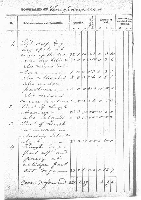
Click on the image to see further details of the valuation
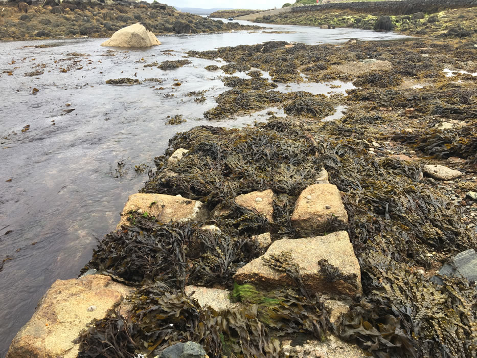
In that same year, 1842, the Ordnance Survey Ireland (OSI) issued a 6-inch map of Ireland. This was the first map of its kind that covered the whole of the country and it was the most detailed thus far. The Loughaconeera map shows that there were two main areas of settlement in the village; one in the eastern end of the village which we now call Barr an Bhaile, and the other in the western end which we call Rusheen.
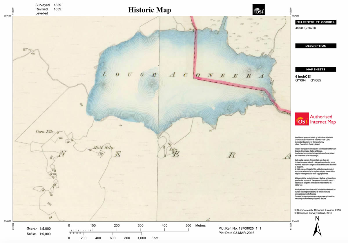
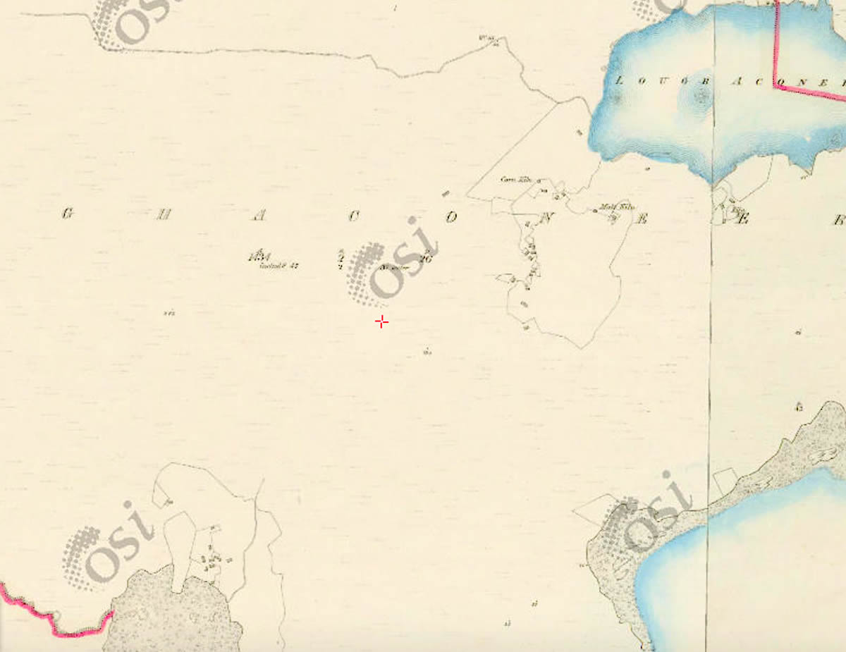
http://maps.osi.ie/publicviewer/#V2,486570,736356,10,7
It was a hard, hungry life at the time and people were prepared to put their lives on the line to feed their families. It was not surprising that they took the law into their own hands and tried to get food by any means.
FATAL AFFRAY IN CONNEMARA.
Accounts have reached town of a fatal affray in one of the islands off the coast of Connemara, early this week. We learn that a great number of men went in boats for the purpose of taking away oysters from the beds belonging to Mr. Martin, M. P., and being warned off, they persevered and flung stones at the keeper in charge when he was obliged to fire upon the party, the consequence of which was, that one man was killed and another severely wounded. We are also informed that Mr. Martin’s men were severely hurt, and some of their limbs fractured.
Cork Examiner March 31, 1847.
LOSS OF THE BARQUE "GEORGE" OF BELFAST
From the Galway Vindicator we copy a fuller account of the loss of this vessel than the notice in our last:-- "The George, of Belfast, Patton, laden with cotton, from New Orleans, and bound to Liverpool, was struck by a heavy sea, on Sunday night se'ennight, between the hours of eleven and twelve o'clock, and driven, by a strong Southerly gale, on Life Island, about two miles eastward of Lettermullin, on the West coast of Galway, where she has become a total wreck.
Master and crew saved, with the exception of a little boy (Charles Forrest, of Liverpool), who, in endeavouring to escape, was washed away and seen no more. Ten or twelve bales of the cottons are, at present, deposited in the Custom-house here; and we are told that the entire bay is dotted with it. Her Majesty's cruiser Dolphin, Commander Lieutenant Goslin, proceeded this morning, the 31st Jan., having on board one or two custom-board officers, to the wreck, but was obliged to return, from the high winds. The master, from whom we learned the above, has also informed us that the inhabitants of and about Life Island committed on the vessel the greatest plunder, and that even a knife was presented to the throat of the second mate, whilst striving to resist being deprived of his clothing."
Galway Vindicator 7th February 1843
Another aspect of the history of Ireland and the unjust effect it had on the poor of the country was the so-called ‘Wholesale Evictions’ of 1851. There is no written evidence that it happened in Loughaconeera, but as it happened in the surrounding villages we are almost certain it happened here also. The census shows that the decline in population of Loughaconeera between 1841 and 1851 was much the same as every townland in the area.
WHOLESALE EVICTIONS
On the 17th September Mr. John ROBERTSON, agent to the mortgagees of the MARTIN estates, accompanied by sixty bailiffs, proceeded to the townland of Derryrush [Galway], and evicted seven families comprising forty-two individuals. The houses were levelled on the instant without the slightest opposition being offered by the evicted. On Nov. 11th, the same party went upon the islands of Dooletter, and evicted two families consisting of ten persons. Nov. 16th, the same party visited the Townlands of Mace and Dooreher, and evicted seventeen families, comprising one hundred persons, and levelled the houses. Nov. 21 same party, proceeded to the town land of Atry and evicted seventeen families, comprising sixty five persons, and unroofed the houses. On the 22nd of November the same party went to the townlands of Cashel, Doonreageran, Rossroe and Glynsk, and evicted sixteen families, comprising eighty-seven human beings, and levelled their houses.
Galway Vindicator, December 4th 1851
After the Famine
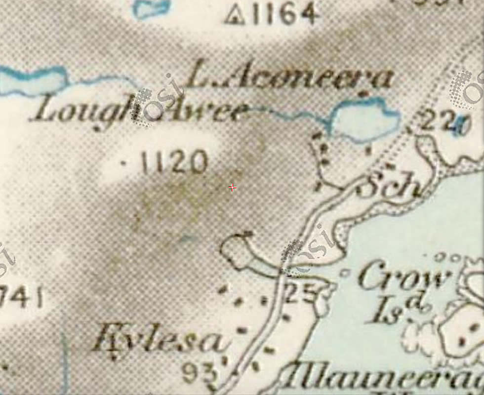
The 25-inch map that was made in the late 1880s gives a different perspective of the village. It shows us that a road was going through the village and that a school was also built.

http://www.askaboutireland.ie/griffith-valuation/index.xml
Griffiths Valuation 1855
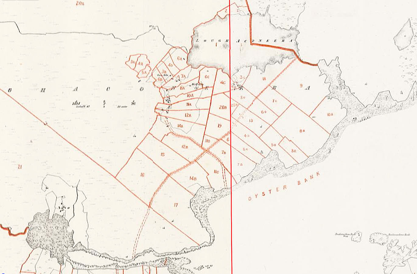
The Griffiths Valuation of 1855 is the most informative and detailed document regarding the area. It gives details about the inhabitants of the village at the time and also shows how the land was divided, in this case into fields, with the layout of the village remaining much the same to this day.
http://www.askaboutireland.ie/
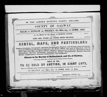
In 1869, the landlord, Marcus Lynch, put the village and all the other villages under his ownership up for sale at an auction in Dublin. The sale document gives detailed information on the tenants, how much land they were renting and the amount of rent they were paying. It is interesting to see that some of the surnames of the tenants on the sale list no longer exist in the village, and that some new surnames have appeared since then.
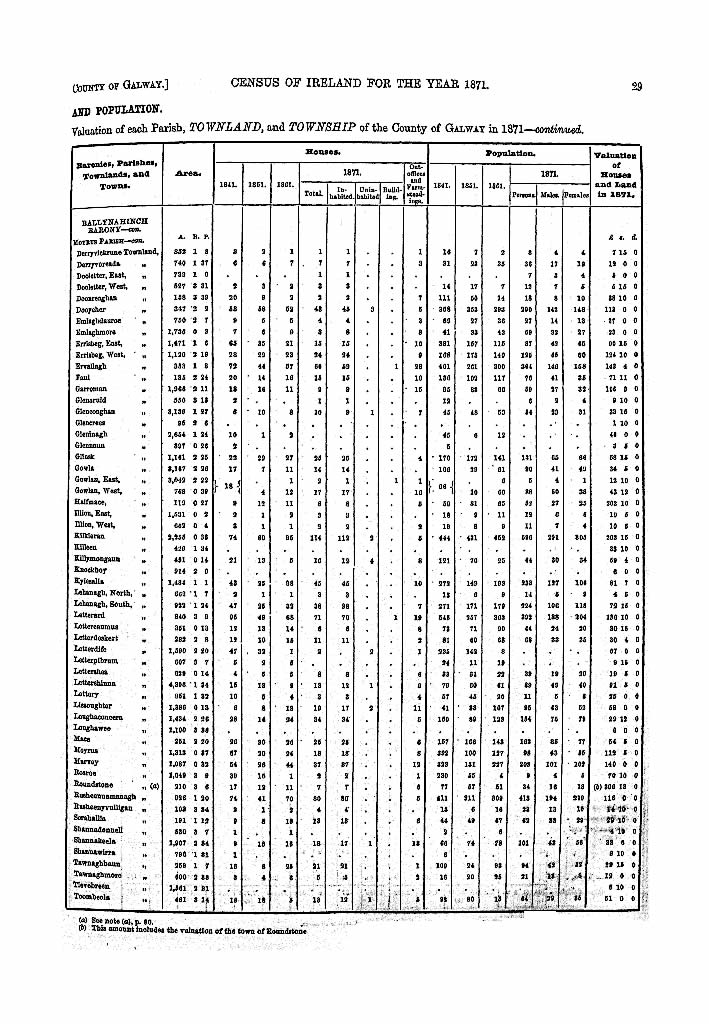
The census of 1881 shows us a gradual increase in population of the village during the previous 30 years.


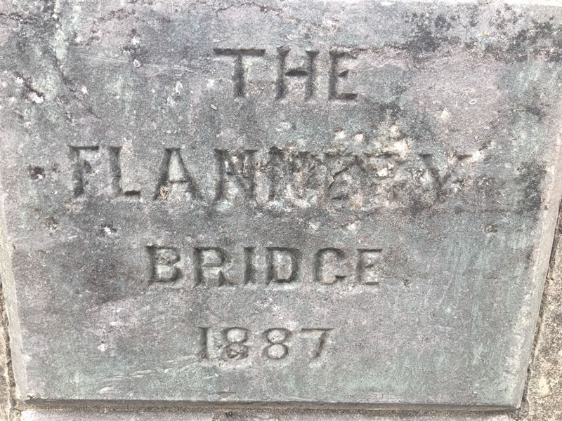
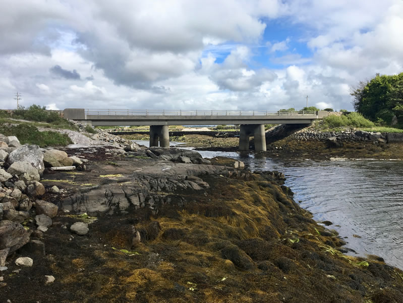
The first bridge was built between Loughaconeera and Kysalia in 1887. It was named after Father Flannery, the Carna priest at the time. He was involved in other projects in the Parish as well; the bridge onto Mynish Island and a school there, and also the school in Loughaconeera. He died in 1891 aged 38.
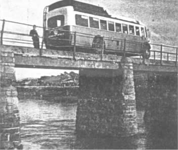
In 1954 a new bridge was built beside the existing one to accommodate more traffic and bigger vehicles. It was built by the construction company Sisk and it was the longest single span bridge in Europe at the time. It was built of concrete which was mixed on site. The fresh water for the concrete was sourced from the Inver River, which was 5 miles east of the site, and transported in barrels by horse and cart.
A third bridge was built in the year 2000 as the structure of the previous one had weakened and was nearly in the state of collapse. There were no records set by the design of this one. It is interesting to note that a new bridge was built crossing this sea inlet in three consecutive centuries.
Emigration
Emigration was the only option available to people at the turn of the 20th century. It was an opportunity to escape the hardship and want of that era in Ireland, and people left the region in their thousands. Most of the people from the village went to America and it most certainly was a shock to the system as most, if not all, would have had very little English or experience in the outside world. But with their relatives there already to guide them, they settled in and bettered themselves but sadly some of them would never return to Ireland again. Emigration is still ongoing to the present day and it is having a huge negative effect on the area and its future.
Poitín, (illict distilling)
There was a lot of poitín made in the village in the past. Whatever profit was made was hard earned as it involved a lot of work which had to be done at night under the cover of darkness. The village had the reputation of making good quality poitín and by all accounts they had no trouble selling it both near and far.
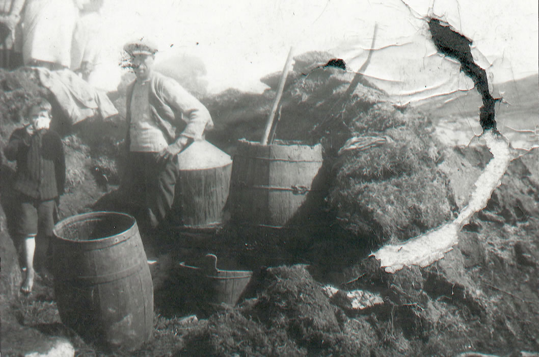
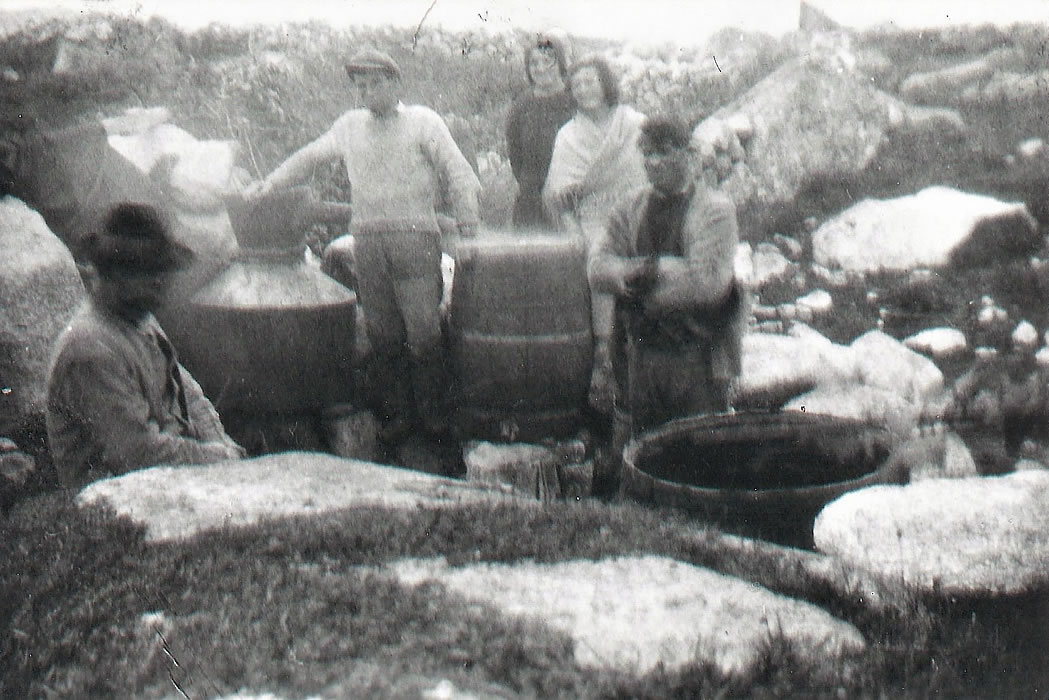
It was illegal to make poitín without a license since Christmas Day 1661. The English government, under Charles II, was trying to bring in as much revenue as possible at the time and by enforcing tax on the distillation of poitín, it drove the small stiller underground. The revenue police carried out raids to put an end to illicit distillation, most times without much success.
Connaught Journal
Printed and Published in Lower Cross-street by Barthw. O'FLAHERTY
Galway, Ireland. Thurs., 20 Feb 1840
The CHICHESTER Revenue Cutter, commanded by Captain STEWART, anchored at Kilkerran bay (Cunemara), received some injury from lightning on the 7th
inst., the Captain having narrowly escaped, but some of the crew received very slight injury. The cutter had been there for the purpose of co-operating with the Revenue Police under the command of Lieutenant M'DERMOTT, at Outerard, for the suppression of illicit distillation, and searched that coast and its many Islands, and we are happy to find there existed no symptoms of any such traffic among the peasantry.
The landlords were not too opposed to illicit distillation, as they knew that their tenants had a better chance of paying their rent with the modest income it provided.
Anyone caught had to pay a heavy fine, but that wasn’t always the case as between the years of 1807 and 1819 it was the townland itself which had to pay the fine. There was a lot of objection to that law and it was abolished in 1819. The poitín era is now long gone and all that is left are the Malt Kilns and traces of long abandoned still houses from the time of our ancestors.

Stillhouse Pholl na Cloiche Bána
GPS: 53.370879,-9.710012
Stillhouse Johnny Cheatín
GPS: 53.363261,-9.706449